

Data
| Identifier | BR-2799 |
|---|---|
| Type | Heliport |
| City | Moreno |
| Region | Pernambuco |
| Country | Brazil |
| Coordinates | -8.09750, -35.17528 |
| Coordinates (deg/min/sec) | 8° 05′ 51.00″ S 35° 10′ 31.00″ W |
| Elevation | 184 m (604 ft) |
| Scheduled service | no |
Travel gear that fits
Automatically selected recommendations for a trip to Margarida Heliport – based on climate, location and airport type.
 Pernambuco travel guide
Routes, towns and day trips across Pernambuco.
View on Amazon- Brazil travel guide
The overview for your trip: regions, culture, getting around and practical tips for Brazil.
View on Amazon  Portuguese phrasebook
The essential phrases in Portuguese – for taxis, hotels and restaurants.
View on Amazon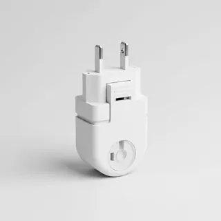 Travel adapter C/N
The destination uses socket types C/N at 127 V – the right adapter keeps everything charged.
View on Amazon Filter water bottle
Where tap water is risky: a bottle with a built-in filter.
View on Amazon Sunscreen SPF 50
High UV exposure at the destination – sun protection belongs in your cabin bag.
View on Amazon
Advertising: as an Amazon Associate we earn from qualifying purchases. The price stays the same for you.
Runways
| Runway | Length | Width | Surface | Lighted |
|---|---|---|---|---|
2 | 19 m | 19 m | Asphalt | no |
Nearby airports
- BR-0285Cepasa Heliport18 km (11 mi)
- SNB6Vera Simone Heliport24 km (15 mi)
- BR-0804Instituto RB Heliport24 km (15 mi)
- BR-1416Hospital Metropolitano Oeste Helipad25 km (15 mi)
- BR-1778Hospital Metropolitano Sul - Dom Helder Câmara Helipad25 km (16 mi)
- BR-0328Águas Finas Heliport25 km (16 mi)
- BR-0379Dois Irmãos Heliport28 km (17 mi)
- BR-3232Compesa Helipad28 km (17 mi)
- SI6XAché Pernambuco Heliport28 km (17 mi)
- RECRecife/Guararapes - Gilberto Freyre International Airport28 km (17 mi)
- SN9FHeliforte Heliport29 km (18 mi)
- SSTTLemon Hotel Heliport30 km (19 mi)