
Eindhoven Airport
IATA EINICAO EHEHLarge airport
Eindhoven Airport is a large airport near Eindhoven in Noord-Brabant, Netherlands. It is listed as IATA EIN and ICAO EHEH. The airport is located at 51.4501° / 5.3745° at an elevation of 23 m (74 ft). There is one runway, the longest measuring 3,000 m. The nearest airport is Maxima Medisch Centrum Heliport, 5.9 km (4 mi) away. The airport is served by scheduled flights.


Data
| IATA code | EIN |
|---|---|
| ICAO code | EHEH |
| Identifier | EHEH |
| Type | Large airport |
| City | Eindhoven |
| Region | Noord-Brabant |
| Country | Netherlands |
| Coordinates | 51.45010, 5.37453 |
| Coordinates (deg/min/sec) | 51° 27′ 00.36″ N 5° 22′ 28.31″ E |
| Elevation | 23 m (74 ft) |
| Scheduled service | yes |
Travel gear that fits
Automatically selected recommendations for a trip to Eindhoven Airport – based on climate, location and airport type.
 Eindhoven travel guide
Sights, neighbourhoods and tips for Eindhoven – ideal for your arrival.
View on Amazon Netherlands travel guide
The overview for your trip: regions, culture, getting around and practical tips for Netherlands.
View on Amazon Dutch phrasebook
The essential phrases in Dutch – for taxis, hotels and restaurants.
View on Amazon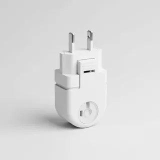 Travel adapter C/F
The destination uses socket types C/F at 230 V – the right adapter keeps everything charged.
View on Amazon Packable rain jacket
Changeable weather at your destination – windproof, water-repellent and packs down small.
View on Amazon Compression socks
Relieve your legs on long-haul flights and long periods of sitting.
View on Amazon
Advertising: as an Amazon Associate we earn from qualifying purchases. The price stays the same for you.
Runways
| Runway | Length | Width | Surface | Lighted |
|---|---|---|---|---|
03/21 | 3,000 m | 45 m | Asphalt | yes |
Links
Nearby airports
- NL-0009Maxima Medisch Centrum Heliport5.9 km (4 mi)
- NL-0046P. van Zutphen Heliport9.5 km (6 mi)
- NL-0010St. Elisabeth Hospital Heliport21 km (13 mi)
- NL-0113Landgoed Marienhof Helipad22 km (14 mi)
- BE-0011Neerpelt/Tilburgs Heliport24 km (15 mi)
- EHBDKempen Airport Budel27 km (17 mi)
- NL-0034Nistelrode Glidersite29 km (18 mi)
- EBWEWeelde Air Base29 km (18 mi)
- EBKHBalen-Keiheuvel Airfield32 km (20 mi)
- EBBLKleine Brogel Air Base32 km (20 mi)
- UDEVolkel Air Base33 km (20 mi)
- GLZGilze Rijen Air Base33 km (21 mi)