
Sunshine Coast Airport
IATA MCYICAO YBSULarge airport
Sunshine Coast Airport is a large airport near Maroochydore in Queensland, Australia. It is listed as IATA MCY and ICAO YBSU. The airport is located at -26.5933° / 153.0832° at an elevation of 5 m (15 ft). There is one runway, the longest measuring 2,800 m. The nearest airport is Old Maroochydore Aerodrome, 7.5 km (5 mi) away. The airport is served by scheduled flights.


Data
| IATA code | MCY |
|---|---|
| ICAO code | YBSU |
| Identifier | YBSU |
| Type | Large airport |
| City | Maroochydore |
| Region | Queensland |
| Country | Australia |
| Coordinates | -26.59332, 153.08319 |
| Coordinates (deg/min/sec) | 26° 35′ 35.97″ S 153° 04′ 59.48″ E |
| Elevation | 5 m (15 ft) |
| Scheduled service | yes |
Travel gear that fits
Automatically selected recommendations for a trip to Sunshine Coast Airport – based on climate, location and airport type.
 Maroochydore travel guide
Sights, neighbourhoods and tips for Maroochydore – ideal for your arrival.
View on Amazon Australia travel guide
The overview for your trip: regions, culture, getting around and practical tips for Australia.
View on Amazon Australia cookbook
The country's cuisine to cook at home – before or after the trip.
View on Amazon Travel adapter I
The destination uses socket types I at 230 V – the right adapter keeps everything charged.
View on Amazon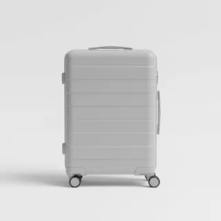 Carry-on trolley
Hard-shell case in standard cabin size – fits the overhead bins of most scheduled flights.
View on Amazon Packable rain jacket
Changeable weather at your destination – windproof, water-repellent and packs down small.
View on Amazon
Advertising: as an Amazon Associate we earn from qualifying purchases. The price stays the same for you.
Runways
| Runway | Length | Width | Surface | Lighted |
|---|---|---|---|---|
13/31 | 2,800 m | 45 m | Asphalt | yes |
18/36 closed | 1,797 m | 30 m | Asphalt | yes |
Links
Nearby airports
- YXNANambour Hospital Helipad13 km (8 mi)
- YXHSSunshine Coast University Hospital Helipad17 km (11 mi)
- NSVNoosa Airport19 km (12 mi)
- YXNONoosa Hospital Helipad22 km (13 mi)
- CUDCaloundra Airport23 km (15 mi)
- AU-0538Tinbeerwah Airstrip (private)24 km (15 mi)
- AU-0246Cooroy School Oval HLS26 km (16 mi)
- AU-0274Landsborough Airport28 km (17 mi)
- AU-0219Greenfield (Cootharaba) Airfield36 km (22 mi)
- AU-0469Kin Kin Oval Helicopter Landing Site42 km (26 mi)
- AU-0617Donnybrook Airstrip47 km (29 mi)
- AU-0253Hazelton Private Airstrip51 km (31 mi)